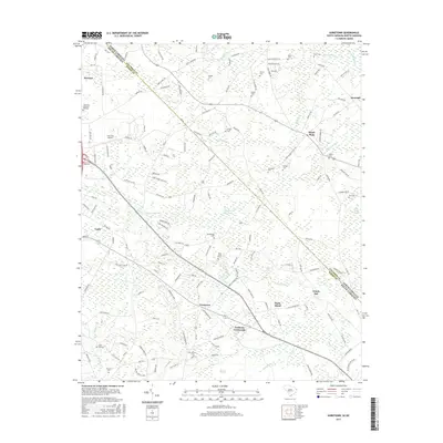
2017 Map of Goretown
USGS Topo · Published 2017About this map
Loris serves as a prominent anchor in the western portion of this 2017 survey, where the border between North Carolina and South Carolina cuts diagonally through the rural landscape of Horry and Columbus counties. The area is defined by a dense network of family-named cemeteries and small settlements like Goretown, Sandy Plain, and Grahams Crossroads, which reflect a deep-rooted lineage of land ownership and community.
Find a feature on this map
148 named features on this map. Tap any name to fly to it.
Don’t see what you’re looking for? This feature index may not catch every label — zoom into the map to look around manually.
Map Details
Editions of this 2017 Goretown Map
This is the sole edition of this map. No revisions or reprints were ever made.
Other maps of this area

1937 · Nixonville
USGS Topo · 1:48,000

1942 · Nixonville
USGS Topo · 1:62,500

1943 · Pireway
USGS Topo · 1:31,680

1943 · Nakina
USGS Topo · 1:24,000

1944 · Longs
USGS Topo · 1:31,680

1949 · Georgetown
USGS Topo · 1:250,000

1953 · Longs
USGS Topo · 1:24,000
1953 · Pireway
USGS Topo · 1:24,000

1953 · Florence
USGS Topo · 1:250,000

1954 · Florence
USGS Topo · 1:250,000