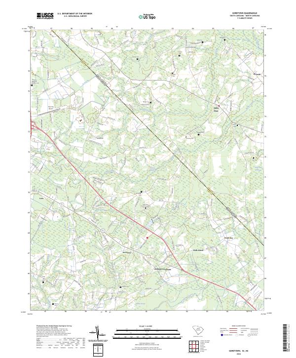
2024 Map of Goretown
USGS Topo · Published 2024About this map
Loris and Goretown anchor this landscape along the border of Horry County and Columbus County, where the Lowcountry terrain is defined by a dense network of watercourses and wetlands. The crossing of the North Carolina and South Carolina state line is marked by a transition from the structured street plan of Loris to the more dispersed agricultural settlements of Sandy Plain and Grahams Crossroads. Water dominates the geography, with Juniper Swamp and Wild Cattle Swamp threading between family-named cemeteries such as Hardee Cem and Wright Cem.
Find a feature on this map
153 named features on this map. Tap any name to fly to it.
Don’t see what you’re looking for? This feature index may not catch every label — zoom into the map to look around manually.
Map Details
Editions of this 2024 Goretown Map
This is the sole edition of this map. No revisions or reprints were ever made.
Other maps of this area

1937 · Nixonville
USGS Topo · 1:48,000

1942 · Nixonville
USGS Topo · 1:62,500

1943 · Pireway
USGS Topo · 1:31,680

1943 · Nakina
USGS Topo · 1:24,000

1944 · Longs
USGS Topo · 1:31,680

1949 · Georgetown
USGS Topo · 1:250,000

1953 · Longs
USGS Topo · 1:24,000
1953 · Pireway
USGS Topo · 1:24,000

1953 · Florence
USGS Topo · 1:250,000

1954 · Florence
USGS Topo · 1:250,000