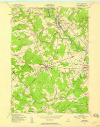
1957 Map of Gorham
USGS Topo · Published 1958About this map
The Presumpscot River and the Maine Central railroad define the industrial and social character of this mid-century landscape in Gorham. At the center of the town, the State Teachers College and High Sch anchor the community, while the Gorham Raceway indicates a local culture of sport and gathering. Further north, the State Reformatory for Men occupies a significant plot near the river bend.
Find a feature on this map
104 named features on this map. Tap any name to fly to it.
Don’t see what you’re looking for? This feature index may not catch every label — zoom into the map to look around manually.
Map Details
Editions of this 1957 Gorham Map
3 editions found
Other maps of this area

1891 · Portland
USGS Topo · 1:62,500

1891 · Buxton
USGS Topo · 1:62,500

1892 · Buxton
USGS Topo · 1:62,500

1893 · Portland
USGS Topo · 1:62,500

1893 · Buxton
USGS Topo · 1:62,500

1894 · Gray
USGS Topo · 1:62,500

1896 · Sebago
USGS Topo · 1:62,500

1898 · Gray
USGS Topo · 1:62,500

1914 · Portland
USGS Topo · 1:48,000

1916 · Portland
USGS Topo · 1:62,500