
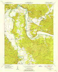
1936 Map of Gorman
USGS Topo · Published 1936About this map
Gorman and Mc Ewen serve as the primary hubs in this mid-1930s landscape, which is defined by the heavy infrastructure of the Tennessee Central Railroad and the Nashville Chattanooga and St Louis Line. The Tennessee Valley Authority, with engineers Arthur E. Morgan and Carl A. Bock at the helm, recorded a region transitioning toward modern electrification, noted by the Electric Power Company Transmission Line and a TEP Co Trans Line cutting across the terrain.
Find a feature on this map
49 named features on this map. Tap any name to fly to it.
Don’t see what you’re looking for? This feature index may not catch every label — zoom into the map to look around manually.
Map Details
Editions of this 1936 Gorman Map
This is the sole edition of this map. No revisions or reprints were ever made.
Other maps of this area

1936 · Hurricane Mills
USGS Topo · 1:24,000

1936 · Woolworth
USGS Topo · 1:24,000

1936 · Ruskin
USGS Topo · 1:24,000

1936 · Bucksnort
USGS Topo · 1:24,000

1936 · Halls Creek
USGS Topo · 1:24,000

1936 · Spot
USGS Topo · 1:24,000

1936 · Waverly
USGS Topo · 1:24,000

1936 · Tennessee City
USGS Topo · 1:24,000

1950 · Halls Creek
USGS Topo · 1:24,000
1950 · Hurricane Mills
USGS Topo · 1:24,000