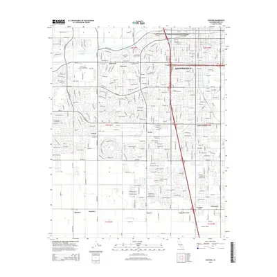
2015 Map of Gosford
USGS Topo · Published 2015About this map
The Bakersfield urban fringe meets the agricultural expansion of the southern San Joaquin Valley on this 2015 topographic survey. The landscape is defined by an intricate network of irrigation and water management, featuring the Kern River, the Friant-Kern Canal, and the Cross Valley Canal alongside numerous ditches like Highline Ditch. These waterways support the outlying settlements of Gosford, Panama, and Pumpkin Center. Higher education is a prominent feature of the local geography, with the campus of California State University-Bakersfield and several vocational colleges including Kaplan College-Bakersfield and San Joaquin Valley College-Bakersfield serving the region. The map documents the dense residential development in Quailwood and Kern City as they spread toward the historic rural community of Old River and the industrial corridors of Wible Orchard.
Find a feature on this map
163 named features on this map. Tap any name to fly to it.
Don’t see what you’re looking for? This feature index may not catch every label — zoom into the map to look around manually.
Map Details
Editions of this 2015 Gosford Map
This is the sole edition of this map. No revisions or reprints were ever made.
Other maps of this area

1906 · Bakersfield
USGS Topo · 1:62,500

1910 · Buena Vista Lake
USGS Topo · 1:125,000

1912 · Buena Vista Lake
USGS Topo · 1:125,000

1914 · Caliente
USGS Topo · 1:125,000

1929 · Stevens
USGS Topo · 1:31,680

1929 · Fairfax School
USGS Topo · 1:31,680

1930 · Weed Patch
USGS Topo · 1:31,680

1930 · Millux
USGS Topo · 1:31,680

1930 · Rosedale
USGS Topo · 1:31,680

1930 · Conner
USGS Topo · 1:31,680