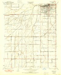
1950 Map of Gosford
USGS Topo · Published 1950About this map
Bakersfield and its burgeoning southwestern outskirts are the focal point of this mid-century landscape, defined by a complex network of irrigation and transportation. The agricultural foundations of Kern County are evident in the dense web of waterways including the Buena Vista Canal, Stine Canal, and James Canal, which supported the surrounding ranch lands. While the northern edge of the map shows the emerging urban grid and the Stockdale Country Club, the southern portion remains largely rural with scattered settlements and educational landmarks. Local history is anchored at sites like Old River, Bannister, and Gosford, while the Southern Pacific railroad provides a heavy industrial artery. This survey reveals a transition from traditional ranching at Bellevue Ranch toward a more structured suburban and industrial footprint, highlighted by the prominence of regional schools like Union Ave Sch and Greenfield Sch.
Find a feature on this map
47 named features on this map. Tap any name to fly to it.
Don’t see what you’re looking for? This feature index may not catch every label — zoom into the map to look around manually.
Map Details
Editions of this 1950 Gosford Map
This is the sole edition of this map. No revisions or reprints were ever made.
Other maps of this area

1906 · Bakersfield
USGS Topo · 1:62,500

1910 · Buena Vista Lake
USGS Topo · 1:125,000

1912 · Buena Vista Lake
USGS Topo · 1:125,000

1914 · Caliente
USGS Topo · 1:125,000

1929 · Stevens
USGS Topo · 1:31,680

1929 · Fairfax School
USGS Topo · 1:31,680

1930 · Weed Patch
USGS Topo · 1:31,680

1930 · Millux
USGS Topo · 1:31,680

1930 · Rosedale
USGS Topo · 1:31,680

1930 · Conner
USGS Topo · 1:31,680