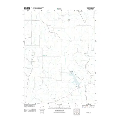
2012 Map of Goshen
USGS Topo · Published 2012About this map
The settlement of Goshen serves as the focal point for this rural Mercer County landscape, where agriculture and water management define the local geography. In the southeastern portion of the map, the substantial Lake Paho is held by the Lake Paho Dam, creating a significant recreational and ecological landmark fed by West Muddy Creek. This reservoir system contrast with the natural meandering paths of Sandy Creek and Brushy Creek that traverse the township sections.
Find a feature on this map
62 named features on this map. Tap any name to fly to it.
Don’t see what you’re looking for? This feature index may not catch every label — zoom into the map to look around manually.
Map Details
Editions of this 2012 Goshen Map
This is the sole edition of this map. No revisions or reprints were ever made.
Other maps of this area

1945 · Lamoni
USGS Topo · 1:62,500

1946 · Princeton
USGS Topo · 1:62,500

1947 · Lamoni
USGS Topo · 1:62,500

1947 · Blythedale
USGS Topo · 1:62,500

1948 · Princeton
USGS Topo · 1:62,500

1954 · Centerville
USGS Topo · 1:250,000

1957 · Centerville
USGS Topo · 1:250,000

1958 · Centerville
USGS Topo · 1:250,000

1964 · Pleasanton
USGS Topo · 1:24,000
1964 · Lineville
USGS Topo · 1:24,000