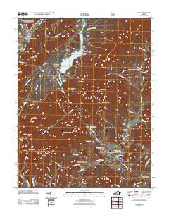
2011 Map of Goshen
USGS Topo · Published 2011About this map
The Maury River carves through the central terrain of Rockbridge County, anchoring a landscape defined by the dramatic Goshen Pass and surrounding ridges. In the early 21st century, this area remains a significant recreation corridor, evidenced by numerous organizational camps including Camp Olmsted, Camp Virginia, and Camp Okahahwis. The Calfpasture River flows into the Lake Merriweather reservoir, a centerpiece for the surrounding Scouting camps.
Find a feature on this map
85 named features on this map. Tap any name to fly to it.
Don’t see what you’re looking for? This feature index may not catch every label — zoom into the map to look around manually.
Map Details
Editions of this 2011 Goshen Map
This is the sole edition of this map. No revisions or reprints were ever made.
Other maps of this area

1894 · Staunton
USGS Topo · 1:125,000

1894 · Natural Bridge
USGS Topo · 1:125,000

1894 · Lexington
USGS Topo · 1:125,000

1901 · Monterey
USGS Topo · 1:125,000

1932 · Lexington
USGS Topo · 1:48,000

1937 · Lexington
USGS Topo · 1:62,500

1943 · Craigsville
USGS Topo · 1:62,500

1945 · Craigsville
USGS Topo · 1:62,500

1946 · Millboro
USGS Topo · 1:62,500

1946 · Williamsville
USGS Topo · 1:62,500