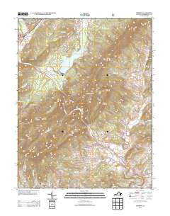
2013 Map of Goshen
USGS Topo · Published 2013About this map
The Little Calfpasture River and Calfpasture River converge near the town of Goshen, carving through a landscape defined by sharp ridges and seasonal camps. This 2013 survey highlights the region's concentration of recreational and youth camps, including Camp Marriott, Camp Bowman, and Camp Okahahwis, which utilize the terrain around Lake Merriweather. To the southeast, the Maury River winds through the dramatic Goshen Pass, a natural gateway between Forge Mountain and Jump Mountain. Small settlements such as Rockbridge Baths and Cedar Grove are clustered along the river valleys, connected by rural routes like Va-602. The mapping of features like Goshen Land Company Bridge and the numerous hollows, such as Stillhouse Hollow and Sulphur Spring Hollow, provides a clear view of the area's local geography and land use patterns in the early 21st century.
Find a feature on this map
112 named features on this map. Tap any name to fly to it.
Don’t see what you’re looking for? This feature index may not catch every label — zoom into the map to look around manually.
Map Details
Editions of this 2013 Goshen Map
This is the sole edition of this map. No revisions or reprints were ever made.
Other maps of this area

1894 · Staunton
USGS Topo · 1:125,000

1894 · Natural Bridge
USGS Topo · 1:125,000

1894 · Lexington
USGS Topo · 1:125,000

1901 · Monterey
USGS Topo · 1:125,000

1932 · Lexington
USGS Topo · 1:48,000

1937 · Lexington
USGS Topo · 1:62,500

1943 · Craigsville
USGS Topo · 1:62,500

1945 · Craigsville
USGS Topo · 1:62,500

1946 · Millboro
USGS Topo · 1:62,500

1946 · Williamsville
USGS Topo · 1:62,500