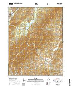
2019 Map of Goshen
USGS Topo · Published 2019About this map
The Calfpasture River and Maury River converge in this high-relief area of Rockbridge County, carving through the dramatic Goshen Pass. The settlement of Goshen sits at the northern edge near the Goshen Land Company Bridge, while the small communities of Wilson Springs, Fredericksburg, and Cedar Grove follow the river valley and southern roads. High ridges like Jump Mtn and Wolf Mtn dominate the center, part of the George Washington National Forest. For genealogists, the map identifies local burial sites such as Little River Cem and Chestnut Grove Cem. The landscape shows a clear pattern of small mountain farms and timbered slopes, with industrial and agricultural history evidenced by the namesake Alone Mill Cr. Much of the northern terrain is defined by the reservoir at Lake Merriweather, which breaks the otherwise narrow river corridor.
Find a feature on this map
92 named features on this map. Tap any name to fly to it.
Don’t see what you’re looking for? This feature index may not catch every label — zoom into the map to look around manually.
Map Details
Editions of this 2019 Goshen Map
This is the sole edition of this map. No revisions or reprints were ever made.
Other maps of this area

1894 · Staunton
USGS Topo · 1:125,000

1894 · Natural Bridge
USGS Topo · 1:125,000

1894 · Lexington
USGS Topo · 1:125,000

1901 · Monterey
USGS Topo · 1:125,000

1932 · Lexington
USGS Topo · 1:48,000

1937 · Lexington
USGS Topo · 1:62,500

1943 · Craigsville
USGS Topo · 1:62,500

1945 · Craigsville
USGS Topo · 1:62,500

1946 · Millboro
USGS Topo · 1:62,500

1946 · Williamsville
USGS Topo · 1:62,500