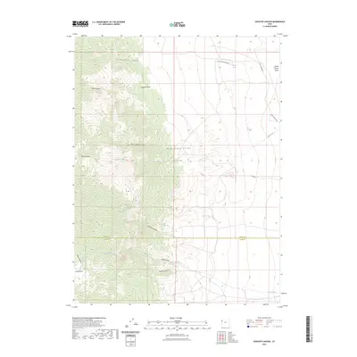
2023 Map of Goshute Canyon
USGS Topo · Published 2023About this map
The Deep Creek Range dominates this corner of the Great Basin, where the high-altitude divide marks the boundary between Tooele Co and Juab Co. This modern topographic study reveals a landscape defined by deep drainages like Hardscrabble Canyon and Goshute Canyon, which cut through the western slopes. To the east, the terrain levels out into the desert floor, where the historic path of the Pony Express Rd remains a primary corridor for travel. Water sources are critical in this arid environment, represented by reliable points like Rock Springs and Eightmile Spring, which likely served as vital stops for early travelers and livestock. The map also traces various ways into the high country, including Pole Canyon Spring Rd, illustrating how modern access continues to follow the natural contours of the mountain range.
Find a feature on this map
20 named features on this map. Tap any name to fly to it.
Don’t see what you’re looking for? This feature index may not catch every label — zoom into the map to look around manually.
Map Details
Editions of this 2023 Goshute Canyon Map
This is the sole edition of this map. No revisions or reprints were ever made.
Other maps of this area

1908 · Fish Springs
USGS Topo · 1:250,000

1910 · Fish Springs
USGS Topo · 1:250,000

1925 · Gold Hill
USGS Topo · 1:62,500

1928 · Gold Hill
USGS Topo · 1:62,500

1953 · Tooele
USGS Topo · 1:250,000

1953 · Delta
USGS Topo · 1:250,000

1955 · Tooele
USGS Topo · 1:250,000

1958 · Delta
USGS Topo · 1:250,000

1962 · Delta
USGS Topo · 1:250,000

1972 · Mud Lake Reservoir
USGS Topo · 1:24,000