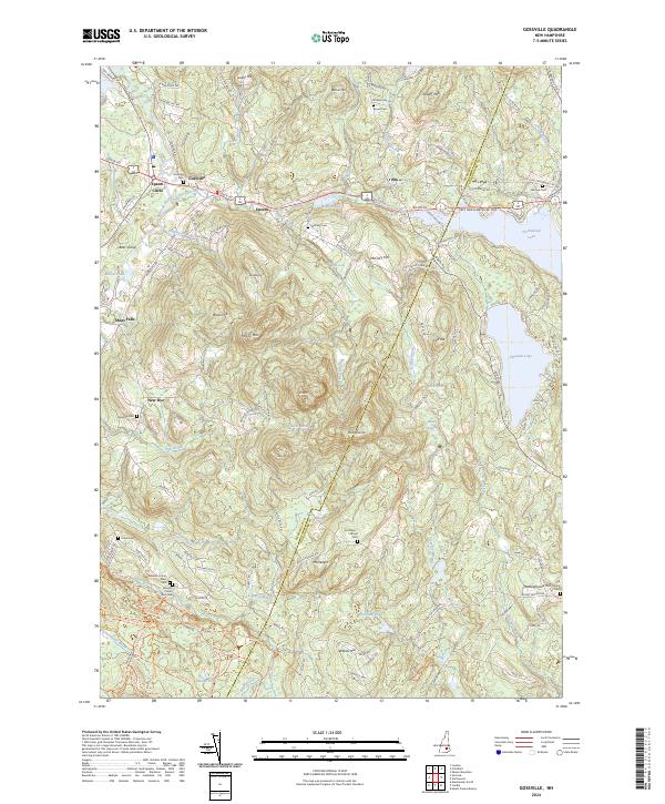
2024 Map of Gossville
USGS Topo · Published 2024About this map
The Suncook River and its tributary, the Little Suncook River, carve a path through this New Hampshire landscape, where historical hamlets like Gossville and Short Falls are situated among the granite hills. This modern survey documents the contemporary boundaries of Merrimack and Rockingham counties, revealing a pattern of settlement that remains closely tied to the high ground of Epsom Mtn and McClary Hill.
Find a feature on this map
117 named features on this map. Tap any name to fly to it.
Don’t see what you’re looking for? This feature index may not catch every label — zoom into the map to look around manually.
Map Details
Editions of this 2024 Gossville Map
This is the sole edition of this map. No revisions or reprints were ever made.
Other maps of this area

1917 · Mt. Pawtuckaway
USGS Topo · 1:62,500

1919 · Mt. Pawtuckaway
USGS Topo · 1:62,500

1919 · Gilmanton
USGS Topo · 1:62,500

1919 · Alton
USGS Topo · 1:62,500

1921 · Suncook
USGS Topo · 1:62,500

1927 · Gilmanton
USGS Topo · 1:62,500

1939 · Mt. Pawtuckaway
USGS Topo · 1:62,500

1944 · Mt. Pawtuckaway
USGS Topo · 1:62,500

1944 · Suncook
USGS Topo · 1:62,500

1949 · Portland
USGS Topo · 1:250,000