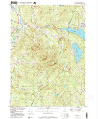
1995 Map of Gossville
USGS Topo · Published 1999About this map
Gossville and Epsom occupy the center of this landscape, situated along the Suncook River and the historical route of the Suncook Valley Railroad. The map reveals a transition from these concentrated village centers to the high peaks of Fort Mtn, Nottingham Mtn, and Nats Mtn, which define the rugged interior between the Merrimack and Rockingham County line. Significant educational and conservation landmarks include the Epsom Central Sch and the northern reaches of Bear Brook State Park.
Find a feature on this map
50 named features on this map. Tap any name to fly to it.
Don’t see what you’re looking for? This feature index may not catch every label — zoom into the map to look around manually.
Map Details
Editions of this 1995 Gossville Map
This is the sole edition of this map. No revisions or reprints were ever made.
Other maps of this area

1917 · Mt. Pawtuckaway
USGS Topo · 1:62,500

1919 · Mt. Pawtuckaway
USGS Topo · 1:62,500

1919 · Gilmanton
USGS Topo · 1:62,500

1919 · Alton
USGS Topo · 1:62,500

1921 · Suncook
USGS Topo · 1:62,500

1927 · Gilmanton
USGS Topo · 1:62,500

1939 · Mt. Pawtuckaway
USGS Topo · 1:62,500

1944 · Mt. Pawtuckaway
USGS Topo · 1:62,500

1944 · Suncook
USGS Topo · 1:62,500

1949 · Portland
USGS Topo · 1:250,000