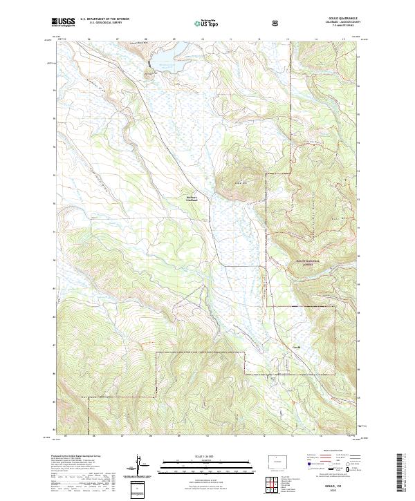
2022 Map of Gould
USGS Topo · Published 2022About this map
The tiny settlement of Gould sits at the foot of the Medicine Bow Mountains, serving as a gateway to the high-country resources of the Routt National Forest. This high-altitude landscape is defined by an intricate network of water management, where the Michigan River and Canadian River headwaters are diverted through numerous man-made channels like the Domestic Supply Ditch and Wagon Wheel Ditch. Further north, Stelbars Lindland marks a distinct point of habitation near the drainage of Peterson Cr.
Find a feature on this map
76 named features on this map. Tap any name to fly to it.
Don’t see what you’re looking for? This feature index may not catch every label — zoom into the map to look around manually.
Map Details
Editions of this 2022 Gould Map
This is the sole edition of this map. No revisions or reprints were ever made.
Other maps of this area

1915 · Longs Peak
USGS Topo · 1:125,000

1916 · Home
USGS Topo · 1:125,000

1919 · Rocky Mountain National Park
USGS Topo · 1:125,000

1920 · Home
USGS Topo · 1:125,000

1954 · Greeley
USGS Topo · 1:250,000

1954 · Craig
USGS Topo · 1:250,000

1955 · Gould
USGS Topo · 1:24,000

1955 · Owl Ridge
USGS Topo · 1:24,000

1955 · Gould NW
USGS Topo · 1:24,000

1956 · Johnny Moore Mountain
USGS Topo · 1:24,000