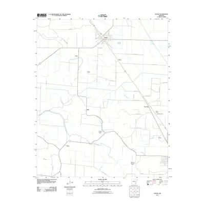
2011 Map of Gould
USGS Topo · Published 2011About this map
The agricultural landscape of Desha County is anchored by Gould, a town defined by its gridded streets like Maple St and Oklahoma St. This 2011 survey reveals a region heavily shaped by water management and aviation, where drainage infrastructure like the Kerch Canal and Ladd Canal supports the surrounding fields. The land is remarkably flat, yet its history is etched into the terrain through several small airfields, including the Billy Free Municipal Airport and the Hudson Landing Strip, which speak to the area's reliance on crop dusting and private aviation for large-scale farming.
Find a feature on this map
40 named features on this map. Tap any name to fly to it.
Don’t see what you’re looking for? This feature index may not catch every label — zoom into the map to look around manually.
Map Details
Editions of this 2011 Gould Map
This is the sole edition of this map. No revisions or reprints were ever made.
Other maps of this area

1935 · Varner
USGS Topo · 1:62,500

1935 · Rotan
USGS Topo · 1:62,500

1935 · Red Fork
USGS Topo · 1:62,500

1935 · Gillett
USGS Topo · 1:62,500

1948 · Helena
USGS Topo · 1:250,000

1950 · Helena
USGS Topo · 1:250,000

1953 · Greenwood
USGS Topo · 1:250,000

1955 · Helena
USGS Topo · 1:250,000

1956 · Greenwood
USGS Topo · 1:250,000

1959 · Helena
USGS Topo · 1:250,000