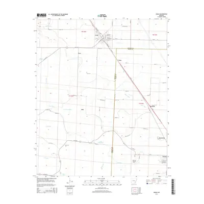
2014 Map of Gould
USGS Topo · Published 2014About this map
Gould sits at the northern edge of this landscape where the Arkansas Delta transitions between Lincoln and Desha counties. The area is defined by a dense network of watercourses and agricultural drainage, including the winding Wagon Bayou and Eugene Bayou. The primary transportation corridor, US 65 Hwy, connects the larger settlements of Mitchellville and Dumas in the south to the smaller clusters of Rotan and Reedville. For those looking into local lineage, the map identifies several family-named or community burial sites such as Thomas Cem, Madden Cem, and Banks Cem. Aviation history is represented by the Billy Free Municipal Airport, while the intricate grid of rural roads like Od Nickols and Huckols Rd provides a look at the modern rural property layout in this section of the Mississippi Alluvial Plain.
Find a feature on this map
71 named features on this map. Tap any name to fly to it.
Don’t see what you’re looking for? This feature index may not catch every label — zoom into the map to look around manually.
Map Details
Editions of this 2014 Gould Map
This is the sole edition of this map. No revisions or reprints were ever made.
Other maps of this area

1935 · Varner
USGS Topo · 1:62,500

1935 · Rotan
USGS Topo · 1:62,500

1935 · Red Fork
USGS Topo · 1:62,500

1935 · Gillett
USGS Topo · 1:62,500

1948 · Helena
USGS Topo · 1:250,000

1950 · Helena
USGS Topo · 1:250,000

1953 · Greenwood
USGS Topo · 1:250,000

1955 · Helena
USGS Topo · 1:250,000

1956 · Greenwood
USGS Topo · 1:250,000

1959 · Helena
USGS Topo · 1:250,000