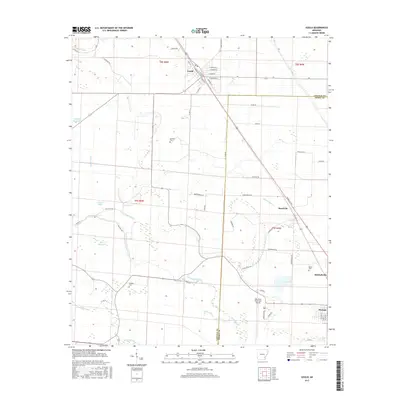
2017 Map of Gould
USGS Topo · Published 2017About this map
The town of Gould serves as the primary hub in this low-lying stretch of the Delta, where the grid-like organization of agricultural land meets a complex network of waterways. Water management dominates the landscape, evidenced by the presence of the Holthoff Reservoir, the Ladd Canal, and the Kerch Canal, all designed to control drainage and irrigation across the fertile plains of Lincoln and Desha Counties. This intersection of human engineering and natural hydrology is further marked by numerous brakes and bayous, including Gibson Brake and the meandering Wagon Bayou.
Find a feature on this map
61 named features on this map. Tap any name to fly to it.
Don’t see what you’re looking for? This feature index may not catch every label — zoom into the map to look around manually.
Map Details
Editions of this 2017 Gould Map
This is the sole edition of this map. No revisions or reprints were ever made.
Other maps of this area

1935 · Varner
USGS Topo · 1:62,500

1935 · Rotan
USGS Topo · 1:62,500

1935 · Red Fork
USGS Topo · 1:62,500

1935 · Gillett
USGS Topo · 1:62,500

1948 · Helena
USGS Topo · 1:250,000

1950 · Helena
USGS Topo · 1:250,000

1953 · Greenwood
USGS Topo · 1:250,000

1955 · Helena
USGS Topo · 1:250,000

1956 · Greenwood
USGS Topo · 1:250,000

1959 · Helena
USGS Topo · 1:250,000