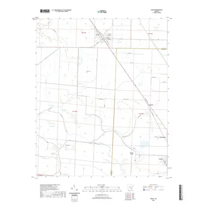
2020 Map of Gould
USGS Topo · Published 2020About this map
Gould serves as the primary municipal center in this section of the Arkansas Delta, where the gridiron streets of the town sit adjacent to an extensive network of drainage and wetlands. The landscape is defined by its complex hydrology, featuring numerous bayous, canals, and brakes that have long shaped local land use and boundaries. Low-lying areas like Gibson Brake and Curry Brake punctuate the agricultural fields, while Choctaw Bayou and the Kerch Canal manage the flow of water through the region.
Find a feature on this map
54 named features on this map. Tap any name to fly to it.
Don’t see what you’re looking for? This feature index may not catch every label — zoom into the map to look around manually.
Map Details
Editions of this 2020 Gould Map
This is the sole edition of this map. No revisions or reprints were ever made.
Other maps of this area

1935 · Varner
USGS Topo · 1:62,500

1935 · Rotan
USGS Topo · 1:62,500

1935 · Red Fork
USGS Topo · 1:62,500

1935 · Gillett
USGS Topo · 1:62,500

1948 · Helena
USGS Topo · 1:250,000

1950 · Helena
USGS Topo · 1:250,000

1953 · Greenwood
USGS Topo · 1:250,000

1955 · Helena
USGS Topo · 1:250,000

1956 · Greenwood
USGS Topo · 1:250,000

1959 · Helena
USGS Topo · 1:250,000