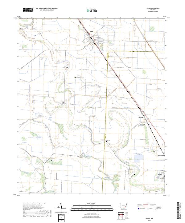
2024 Map of Gould
USGS Topo · Published 2024About this map
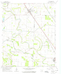
Gould serves as the primary hub for this Delta landscape where Lincoln and Desha counties meet. The town's grid is oriented around the railroad corridor, with streets like E Monroe St and Arkansas St radiating from the center. The surrounding terrain is defined by a dense network of slow-moving waterways and drainage infrastructure, including Choctaw Bayou, Wagon Bayou, and the Ladd Canal. Family and community history is preserved across the agricultural flats in numerous small burial grounds such as Holthoff Cem, Dark Corner Cem, and Almeta Cem.. To the southeast, the settlements of Reedville, Mitchellville, and the outskirts of Dumas follow the highway and rail lines, illustrating the linear development patterns common to this fertile region. Large wetland features like Gibson Brake and Curry Brake punctuate the grid of section lines and rural roads.
Find a feature on this map
66 named features on this map. Tap any name to fly to it.
Don’t see what you’re looking for? This feature index may not catch every label — zoom into the map to look around manually.
Map Details
Editions of this 2024 Gould Map
This is the sole edition of this map. No revisions or reprints were ever made.