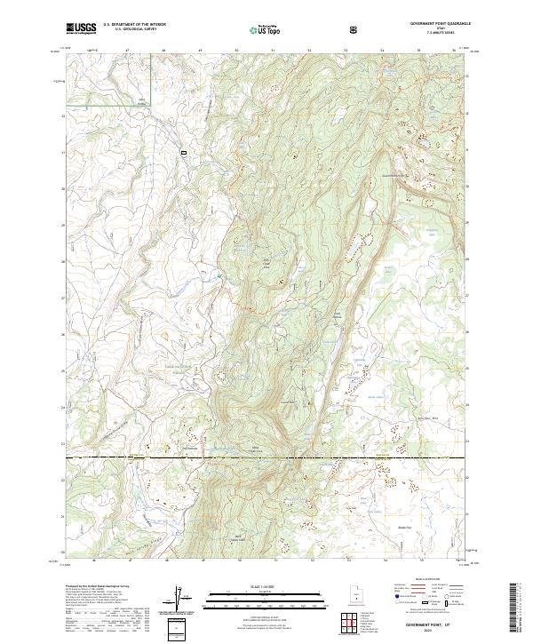
2023 Map of Government Point
USGS Topo · Published 2023About this map
Dixie National Forest dominates this high-altitude landscape where Wayne and Garfield counties meet. The terrain is defined by the massive rise of Boulder Mtn and the prominent Government Point, a landscape carved by numerous drainages including Dark Valley and Sam Legg Hollow. This survey illustrates a complex network of high-country water resources, ranging from natural features like Alkali Lake and Lava Lake to the managed Pine Cr Reservoir. The map documents a rugged interior accessed primarily by specialized routes such as the Great Western Ohv Alternate Trl and the Wildcat Trl. These trails link remote landmarks like Lookout Peak and Miller Creek Cove, reflecting the area's history as a center for forest management and remote recreation.
Find a feature on this map
55 named features on this map. Tap any name to fly to it.
Don’t see what you’re looking for? This feature index may not catch every label — zoom into the map to look around manually.
Map Details
Editions of this 2023 Government Point Map
This is the sole edition of this map. No revisions or reprints were ever made.
Other maps of this area

1885 · Fish Lake
USGS Topo · 1:250,000

1896 · Fish Lake
USGS Topo · 1:250,000

1952 · Notom 3 SW
USGS Topo · 1:24,000

1952 · Loa 1 SE
USGS Topo · 1:24,000

1952 · Notom 3 NW
USGS Topo · 1:24,000

1952 · Notom 2 SW
USGS Topo · 1:24,000

1952 · Grover
USGS Topo · 1:62,500

1952 · Torrey
USGS Topo · 1:62,500

1953 · Loa 4 NE
USGS Topo · 1:24,000

1956 · Salina
USGS Topo · 1:250,000