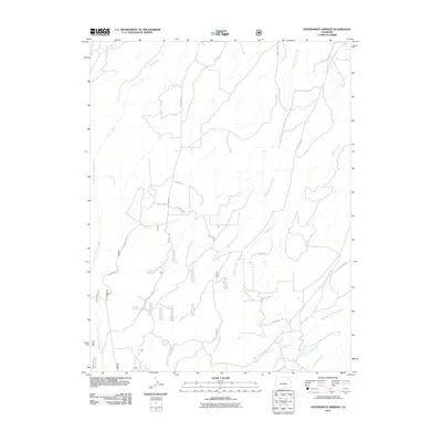
2011 Map of Government Springs
USGS Topo · Published 2011About this map
Government Springs and a series of high-altitude water sources define this Montrose County landscape in the early twenty-first century. The terrain is characterized by a network of drainage systems including Happy Canyon Creek, Dolores Creek, and Spring Creek, which carve through the elevated topography of Sims Mesa. A specific concentration of named water features like Branson Spring, Brown Spring, and Dewdrop Springs indicates the vital importance of natural springs in this arid region. Transportation across the mesa is anchored by Dave Wood Rd, supplemented by smaller tracks such as Bible Camp Rd and Gypsy Ln. The map also details more contemporary infrastructure like the Power Line Rd, which cuts across the southern portion of the quadrangle near Barns Pt. This survey provides a precise record of the land use patterns and natural water resources at the edge of the Uncompahgre Plateau.
Find a feature on this map
31 named features on this map. Tap any name to fly to it.
Don’t see what you’re looking for? This feature index may not catch every label — zoom into the map to look around manually.
Map Details
Editions of this 2011 Government Springs Map
This is the sole edition of this map. No revisions or reprints were ever made.
Other maps of this area

1909 · Montrose
USGS Topo · 1:125,000

1911 · Montrose
USGS Topo · 1:125,000

1956 · Montrose
USGS Topo · 1:250,000

1956 · Moab
USGS Topo · 1:250,000

1959 · Moab
USGS Topo · 1:250,000

1959 · Montrose
USGS Topo · 1:250,000

1960 · Montrose
USGS Topo · 1:250,000

1960 · Moab
USGS Topo · 1:250,000

1962 · Moab
USGS Topo · 1:250,000
1962 · Montrose East
USGS Topo · 1:24,000