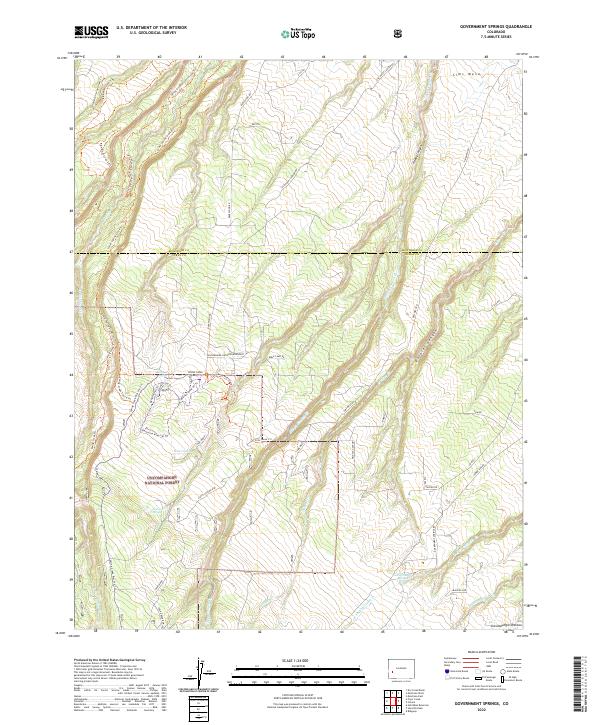
2022 Map of Government Springs
USGS Topo · Published 2022About this map
The Uncompahgre National Forest dominates this section of the western slope, where the high terrain of the Uncompahgre Plateau breaks into a complex system of canyons and mesas. Settled along the boundary of Montrose and Ouray counties, the landscape is defined by the deep incisions of Dolores Canyon and Wildcat Canyon. This 2022 survey captures a modern recreation network overlaid on historic land divisions, with numerous specialized paths like the Plantation Alley Ski Trl and Branson Loop Ski Trl situated near water sources such as Branson Spring and Brown Spring. The road network, including the prominent Dave Wood Rd and Sims Mesa Rd, provides access across the flat-topped Sims Mesa, illustrating how modern infrastructure follows the natural topography of the rim and canyon floor.
Find a feature on this map
54 named features on this map. Tap any name to fly to it.
Don’t see what you’re looking for? This feature index may not catch every label — zoom into the map to look around manually.
Map Details
Editions of this 2022 Government Springs Map
This is the sole edition of this map. No revisions or reprints were ever made.
Other maps of this area

1909 · Montrose
USGS Topo · 1:125,000

1911 · Montrose
USGS Topo · 1:125,000

1956 · Montrose
USGS Topo · 1:250,000

1956 · Moab
USGS Topo · 1:250,000

1959 · Moab
USGS Topo · 1:250,000

1959 · Montrose
USGS Topo · 1:250,000

1960 · Montrose
USGS Topo · 1:250,000

1960 · Moab
USGS Topo · 1:250,000

1962 · Moab
USGS Topo · 1:250,000
1962 · Montrose East
USGS Topo · 1:24,000