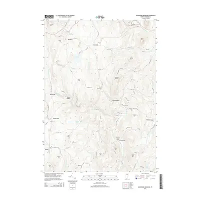
2015 Map of Governors Mountain
USGS Topo · Published 2015About this map
Governors Mountain stands at the heart of this Vermont landscape, where the town of Marlboro and the campus of Marlboro Coll occupy the high ground to the north. The area is defined by a network of steep hills and narrow valleys, drained by waterways such as Whetstone Brook and the Green River. A significant concentration of small family and community burial grounds, including the Thomas Hill-Bell-Phelps Cem and Winchester Cem, are scattered across the terrain, reflecting the long-standing agricultural and residential roots of Windham County. In the south, the Green River Covered Bridge serves as a notable landmark near the settlement of Green River. The map details a transition from the structured academic environment at Marlboro to the more dispersed rural communities of West Guilford and Whitneyville, all connected by a dense web of secondary roads like Church Hollow Rd and Guilford Center Rd.
Find a feature on this map
89 named features on this map. Tap any name to fly to it.
Don’t see what you’re looking for? This feature index may not catch every label — zoom into the map to look around manually.
Map Details
Editions of this 2015 Governors Mountain Map
This is the sole edition of this map. No revisions or reprints were ever made.
Other maps of this area

1886 · Hawley
USGS Topo · 1:62,500

1889 · Wilmington
USGS Topo · 1:62,500

1890 · Hawley
USGS Topo · 1:62,500

1890 · Greenfield
USGS Topo · 1:62,500

1891 · Wilmington
USGS Topo · 1:62,500

1891 · Brattleboro
USGS Topo · 1:62,500

1893 · Brattleboro
USGS Topo · 1:62,500

1894 · Greenfield
USGS Topo · 1:62,500

1894 · Hawley
USGS Topo · 1:62,500

1899 · Wilmington
USGS Topo · 1:62,500