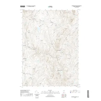
2018 Map of Governors Mountain
USGS Topo · Published 2018About this map
Green River flows through the heart of this Windham County landscape, marked by its landmark Green River Covered Bridge and the small settlements of West Guilford and Whitneyville. The terrain is characterized by a dense network of wooded uplands, including Governors Mtn, Jolly Mtn, and Ames Hill, interspersed with small ponds like South Pond and Deer Park Pond. This 2018 survey documents a modern rural Vermont character where education at Marlboro College and historic preservation coexist with the quiet legacy of early homesteads.
Find a feature on this map
101 named features on this map. Tap any name to fly to it.
Don’t see what you’re looking for? This feature index may not catch every label — zoom into the map to look around manually.
Map Details
Editions of this 2018 Governors Mountain Map
This is the sole edition of this map. No revisions or reprints were ever made.
Other maps of this area

1886 · Hawley
USGS Topo · 1:62,500

1889 · Wilmington
USGS Topo · 1:62,500

1890 · Hawley
USGS Topo · 1:62,500

1890 · Greenfield
USGS Topo · 1:62,500

1891 · Wilmington
USGS Topo · 1:62,500

1891 · Brattleboro
USGS Topo · 1:62,500

1893 · Brattleboro
USGS Topo · 1:62,500

1894 · Greenfield
USGS Topo · 1:62,500

1894 · Hawley
USGS Topo · 1:62,500

1899 · Wilmington
USGS Topo · 1:62,500