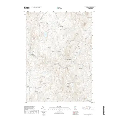
2021 Map of Governors Mountain
USGS Topo · Published 2021About this map
Marlboro and West Guilford characterize the settled landscape of Windham County, Vermont, in this 2021 topographic survey. The region is defined by prominent peaks like Governors Mtn, Lyman Hill, and Ginseng Hill, while the Green River and Whetstone Brook wind through the valleys. Local historians and genealogists will find numerous points of interest, including a dense concentration of burial grounds such as First Cem, King Cem, and the uniquely named Thomas Hill-Bell / Phelps Cem. Educational and architectural landmarks are also noted, specifically Marlboro College and the Green River Covered Bridge. The web of local thoroughfares like Marlboro Rd and Town Hill Rd links smaller communities such as Whitneyville and Harrisville, illustrating the enduring rural infrastructure of the Green Mountain State.
Find a feature on this map
103 named features on this map. Tap any name to fly to it.
Don’t see what you’re looking for? This feature index may not catch every label — zoom into the map to look around manually.
Map Details
Editions of this 2021 Governors Mountain Map
This is the sole edition of this map. No revisions or reprints were ever made.
Other maps of this area

1886 · Hawley
USGS Topo · 1:62,500

1889 · Wilmington
USGS Topo · 1:62,500

1890 · Hawley
USGS Topo · 1:62,500

1890 · Greenfield
USGS Topo · 1:62,500

1891 · Wilmington
USGS Topo · 1:62,500

1891 · Brattleboro
USGS Topo · 1:62,500

1893 · Brattleboro
USGS Topo · 1:62,500

1894 · Greenfield
USGS Topo · 1:62,500

1894 · Hawley
USGS Topo · 1:62,500

1899 · Wilmington
USGS Topo · 1:62,500