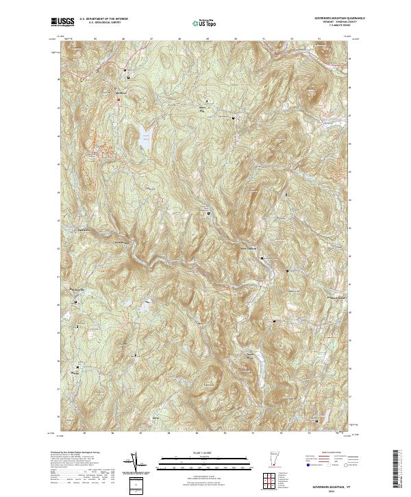
2024 Map of Governors Mountain
USGS Topo · Published 2024About this map
Marlboro College and the surrounding high ground of southern Vermont define this landscape, where early institutional roots meet a deeply carved river network. The topography is dominated by peaks like Governors Mtn and Owls Head Mtn, which separate the drainage of Whetstone Brook in the north from the southern reaches of the Green River. This modern topographic survey illustrates a classic New England settlement pattern, where small hubs such as Marlboro and Guilford Center are connected by narrow roads like Stage Rd and Guilford Center Rd that follow the contours of the hills.
Find a feature on this map
89 named features on this map. Tap any name to fly to it.
Don’t see what you’re looking for? This feature index may not catch every label — zoom into the map to look around manually.
Map Details
Editions of this 2024 Governors Mountain Map
This is the sole edition of this map. No revisions or reprints were ever made.
Other maps of this area

1886 · Hawley
USGS Topo · 1:62,500

1889 · Wilmington
USGS Topo · 1:62,500

1890 · Hawley
USGS Topo · 1:62,500

1890 · Greenfield
USGS Topo · 1:62,500

1891 · Wilmington
USGS Topo · 1:62,500

1891 · Brattleboro
USGS Topo · 1:62,500

1893 · Brattleboro
USGS Topo · 1:62,500

1894 · Greenfield
USGS Topo · 1:62,500

1894 · Hawley
USGS Topo · 1:62,500

1899 · Wilmington
USGS Topo · 1:62,500