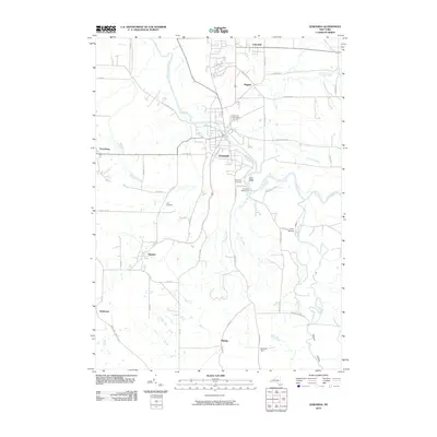
2010 Map of Gowanda
USGS Topo · Published 2010About this map
Cattaraugus Creek carves a deep path through this landscape, defining the topography and local boundaries of the Southern Tier. The waterway flows through the dramatic Zoar Valley and passes the village of Gowanda, where the Gowanda Waterworks and Broadway Cemetery sit above the riverbanks. The surrounding terrain is a network of small agricultural settlements and hamlets, including Bagdad, Dayton, and Perrysburg. Genealogists will find several burial grounds mapped, such as Pine Hill Cemetery and Jolls Cemetery. The intricate drainage system of the area is highlighted by Thatcher Brook and Point Peter Brook, which feed into the main creek. Southward, the map details the rural character of Persia and the small enclave of Markhams, connected by a web of local roads like Skinner Hollow Rd and Forty Rd.
Find a feature on this map
53 named features on this map. Tap any name to fly to it.
Don’t see what you’re looking for? This feature index may not catch every label — zoom into the map to look around manually.
Map Details
Editions of this 2010 Gowanda Map
This is the sole edition of this map. No revisions or reprints were ever made.
Other maps of this area

1899 · Silver Creek
USGS Topo · 1:62,500

1900 · Cherry Creek
USGS Topo · 1:62,500

1905 · Eden
USGS Topo · 1:62,500

1907 · Eden
USGS Topo · 1:62,500

1923 · Cattaraugus
USGS Topo · 1:62,500

1938 · Cattaraugus
USGS Topo · 1:62,500

1941 · Cattaraugus
USGS Topo · 1:62,500

1941 · Cherry Creek
USGS Topo · 1:62,500

1944 · Eden
USGS Topo · 1:62,500

1944 · North Collins
USGS Topo · 1:31,680