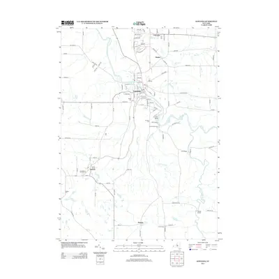
2013 Map of Gowanda
USGS Topo · Published 2013About this map
Cattaraugus Cr winds through this Western New York landscape, carving a deep valley that separates the northern settlements of Collins and Bagdad from the southern reaches of Persia. The village of Gowanda serves as a central hub, where the topography transitions from the steep walls of Zoar Valley to the broader flats of the creek's lower reaches. This 2013 survey provides a detailed view of the regional infrastructure, from the Gowanda Waterworks to the numerous burial grounds that dot the countryside, including Pine Hill Cem, Maltbie Cem, and Broadway Cem.
Find a feature on this map
106 named features on this map. Tap any name to fly to it.
Don’t see what you’re looking for? This feature index may not catch every label — zoom into the map to look around manually.
Map Details
Editions of this 2013 Gowanda Map
This is the sole edition of this map. No revisions or reprints were ever made.
Other maps of this area

1899 · Silver Creek
USGS Topo · 1:62,500

1900 · Cherry Creek
USGS Topo · 1:62,500

1905 · Eden
USGS Topo · 1:62,500

1907 · Eden
USGS Topo · 1:62,500

1923 · Cattaraugus
USGS Topo · 1:62,500

1938 · Cattaraugus
USGS Topo · 1:62,500

1941 · Cattaraugus
USGS Topo · 1:62,500

1941 · Cherry Creek
USGS Topo · 1:62,500

1944 · Eden
USGS Topo · 1:62,500

1944 · North Collins
USGS Topo · 1:31,680