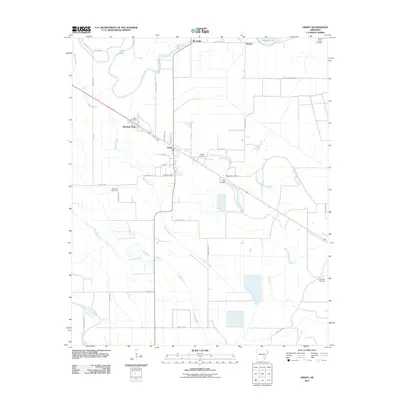
2011 Map of Grady
USGS Topo · Published 2011About this map
Grady is the primary hub of this Lincoln County landscape, situated where the W Railroad and several county routes intersect. The town's surrounding agricultural lands are defined by a complex drainage network, including the meandering Bayou Bartholomew in the southwest and Wagon Bayou which cuts through the center. This drainage pattern dictates the placement of numerous small settlements and family-named landmarks that have persisted through generations of Delta farming.
Find a feature on this map
45 named features on this map. Tap any name to fly to it.
Don’t see what you’re looking for? This feature index may not catch every label — zoom into the map to look around manually.
Map Details
Editions of this 2011 Grady Map
This is the sole edition of this map. No revisions or reprints were ever made.
Other maps of this area

1935 · Feenyville
USGS Topo · 1:62,500

1935 · Varner
USGS Topo · 1:62,500

1935 · Noble Lake
USGS Topo · 1:62,500

1935 · Rotan
USGS Topo · 1:62,500

1948 · Helena
USGS Topo · 1:250,000

1950 · Helena
USGS Topo · 1:250,000

1953 · Greenwood
USGS Topo · 1:250,000

1955 · Helena
USGS Topo · 1:250,000

1956 · Greenwood
USGS Topo · 1:250,000

1959 · Helena
USGS Topo · 1:250,000