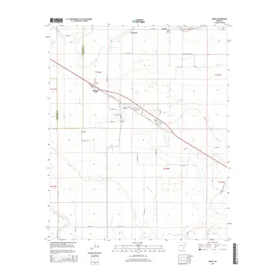
2014 Map of Grady
USGS Topo · Published 2014About this map
Grady serves as the central hub of this Lincoln County landscape, where the agricultural grid meets the winding courses of the Arkansas delta's waterways. The town's layout is defined by the intersection of S Main St and N Grady Ave, positioned just south of Shannon Tank. The area is notably dense with small family and community burial grounds, such as Hawley Cem and Gocio Cem, providing significant touchpoints for genealogical research. Water dominates the eastern and southern reaches of the quadrangle, with the broad path of Wagon Bayou and the oxbow-like Sarassa Lake illustrating the natural drainage patterns of the lowlands. Further west, Deep Bayou snakes through the terrain near the Jefferson County line, while the AR River Levee in the northeast corner serves as a reminder of the region's managed relationship with the river system.
Find a feature on this map
68 named features on this map. Tap any name to fly to it.
Don’t see what you’re looking for? This feature index may not catch every label — zoom into the map to look around manually.
Map Details
Editions of this 2014 Grady Map
This is the sole edition of this map. No revisions or reprints were ever made.
Other maps of this area

1935 · Feenyville
USGS Topo · 1:62,500

1935 · Varner
USGS Topo · 1:62,500

1935 · Noble Lake
USGS Topo · 1:62,500

1935 · Rotan
USGS Topo · 1:62,500

1948 · Helena
USGS Topo · 1:250,000

1950 · Helena
USGS Topo · 1:250,000

1953 · Greenwood
USGS Topo · 1:250,000

1955 · Helena
USGS Topo · 1:250,000

1956 · Greenwood
USGS Topo · 1:250,000

1959 · Helena
USGS Topo · 1:250,000