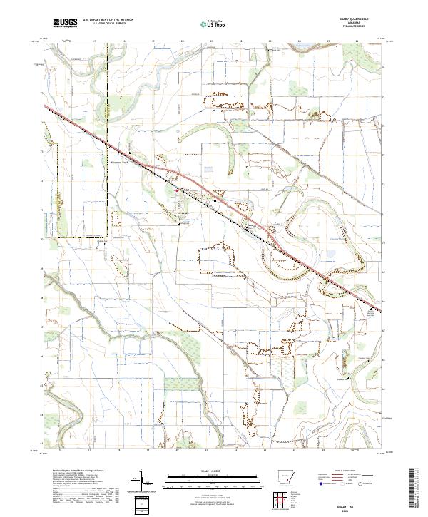
2024 Map of Grady
USGS Topo · Published 2024About this map
Grady is the central hub of this agricultural landscape along the Jefferson and Lincoln County line. The settlement pattern follows the diagonal path of W Railroad St and Old US Hwy 65, which parallel the historical rail corridor. The area is notable for its high density of family and community burial grounds, including Pleasant Grove Cem, Gocio Cem, and the Lincoln Memorial Lawn Cem, which serve as vital markers for genealogical research in this part of Arkansas.
Find a feature on this map
59 named features on this map. Tap any name to fly to it.
Don’t see what you’re looking for? This feature index may not catch every label — zoom into the map to look around manually.
Map Details
Editions of this 2024 Grady Map
This is the sole edition of this map. No revisions or reprints were ever made.
Other maps of this area

1935 · Feenyville
USGS Topo · 1:62,500

1935 · Varner
USGS Topo · 1:62,500

1935 · Noble Lake
USGS Topo · 1:62,500

1935 · Rotan
USGS Topo · 1:62,500

1948 · Helena
USGS Topo · 1:250,000

1950 · Helena
USGS Topo · 1:250,000

1953 · Greenwood
USGS Topo · 1:250,000

1955 · Helena
USGS Topo · 1:250,000

1956 · Greenwood
USGS Topo · 1:250,000

1959 · Helena
USGS Topo · 1:250,000