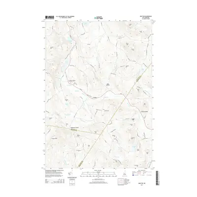
2015 Map of Grafton
USGS Topo · Published 2015About this map
The Smith River winds through this New Hampshire upland, connecting the primary settlements of Grafton, Grafton Center, and East Grafton. This landscape is defined by its numerous water bodies and significant relief, with prominent peaks like Isinglass Mtn and Melvin Mtn rising above the valley floors. Genealogists and local historians can locate established landmarks such as the Prescott Hill Cem and the small communities at Robinson Corner and Fowlertown. The map details a network of named heights, including Fogg Hill, Smith Mtn, and Williams Hill, which overlook various ponds and brooks. Industry and transport history are evident at Fords Mill and Fords Crossing along the river, while the southern portion is marked by the expansive Waukeena Lake and the drainage of Walker Brook.
Find a feature on this map
107 named features on this map. Tap any name to fly to it.
Don’t see what you’re looking for? This feature index may not catch every label — zoom into the map to look around manually.
Map Details
Editions of this 2015 Grafton Map
This is the sole edition of this map. No revisions or reprints were ever made.
Other maps of this area

1902 · Sunapee
USGS Topo · 1:62,500

1905 · Sunapee
USGS Topo · 1:62,500

1907 · Sunapee
USGS Topo · 1:62,500

1927 · Cardigan
USGS Topo · 1:62,500

1927 · Mascoma
USGS Topo · 1:62,500

1928 · Mount Kearsarge
USGS Topo · 1:62,500

1930 · Cardigan
USGS Topo · 1:62,500

1931 · Mount Kearsarge
USGS Topo · 1:62,500

1932 · Mascoma
USGS Topo · 1:62,500

1949 · Portland
USGS Topo · 1:250,000