
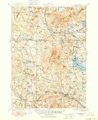
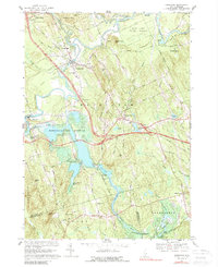
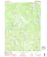
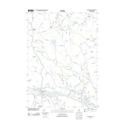
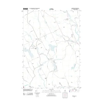
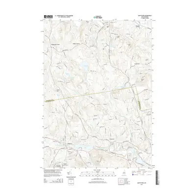
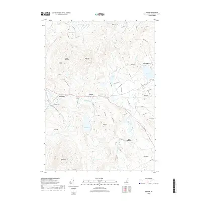
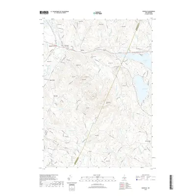
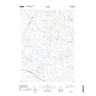
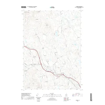
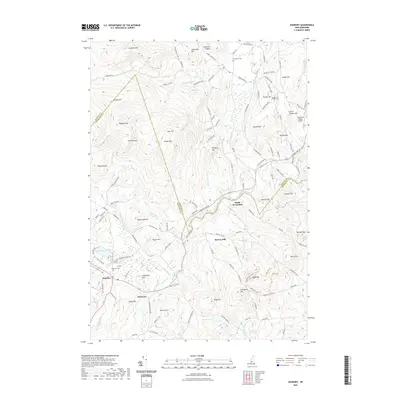
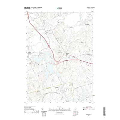
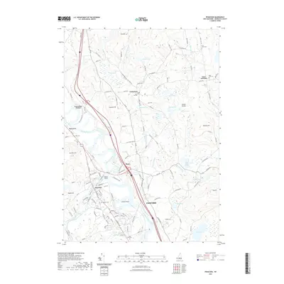
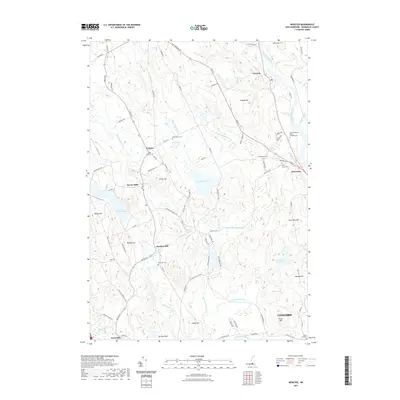
1931 Map of Mount Kearsarge
USGS Topo · Published 1931About this map
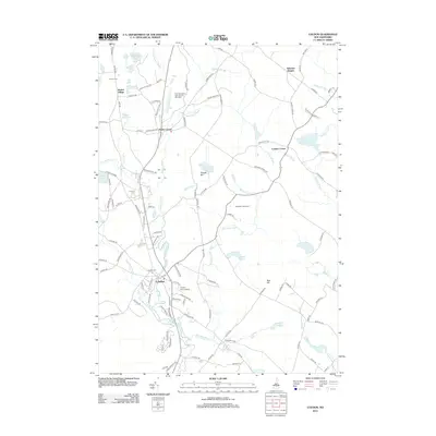
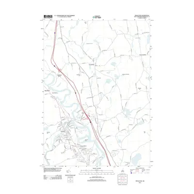
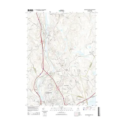
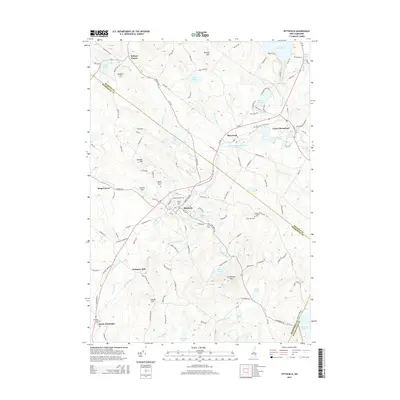
The Boston and Maine RR corridors define the early 20th-century landscape of Merrimack County, linking small manufacturing hamlets and agricultural centers along the Blackwater River and Warner River. The map captures a moment when the rail-stop economy was still vibrant, evidenced by settlements like Potter Place, South Danbury, and Converse Sta. While industry is marked by sites like Cilleyville and the Shingle Mill Corner, the region's character as a burgeoning recreational retreat is already visible through the presence of the Ragged Mtn Club and the Fair Grounds near Bradford. Genealogy researchers will find significant value in the dense network of rural schoolhouses, including the Langley School, Stearns School, and Mountain School, alongside family-named landmarks like Farnum Hill and Fellows Hill. The rugged geography of the Ragged Mtn range and the Cilleyville Mountains creates a dramatic backdrop for the numerous small ponds and lakes, such as Pleasant Lake and Kezar Lake, that supported these hilltop communities.
Find a feature on this map
149 named features on this map. Tap any name to fly to it.
Don’t see what you’re looking for? This feature index may not catch every label — zoom into the map to look around manually.
Map Details
Editions of this 1931 Mount Kearsarge Map
This is the sole edition of this map. No revisions or reprints were ever made.
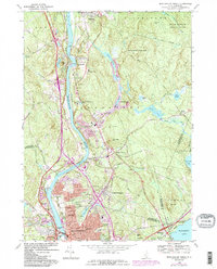
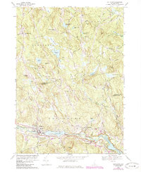
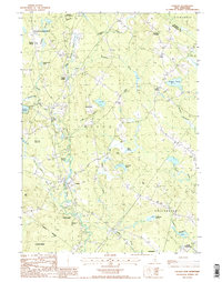
Historical Maps of New London Through Time
111 maps found

1927 Penacook
Merrimack County, NH
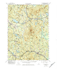
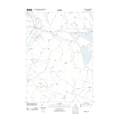
1928 Mount Kearsarge
Merrimack County, NH
1931 Mount Kearsarge
Merrimack County, NH
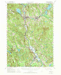
1956 Mt. Kearsarge
Merrimack County, NH
1956 Penacook
Merrimack County, NH
1967 Gossville
Merrimack County, NH
1967 Hopkinton
Merrimack County, NH
1968 Manchester North
Merrimack County, NH
1969 Goffstown
Merrimack County, NH

1977 Manchester North
Merrimack County, NH

1987 Andover
Merrimack County, NH

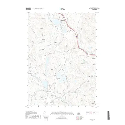
1987 Bradford
Merrimack County, NH

1987 Danbury
Merrimack County, NH

1987 Henniker
Merrimack County, NH
1987 Loudon
Merrimack County, NH

1987 New London
Merrimack County, NH

1987 Northfield
Merrimack County, NH

1987 Penacook
Merrimack County, NH

1987 Pittsfield
Merrimack County, NH

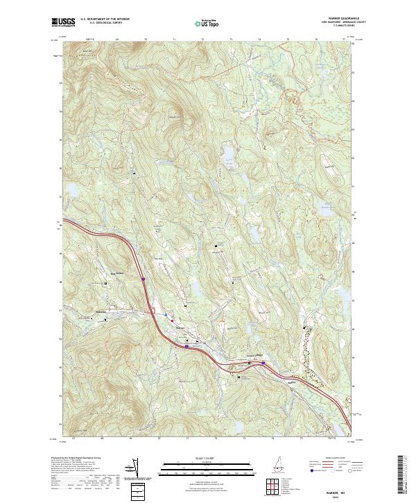
1987 Warner
Merrimack County, NH
1987 Webster
Merrimack County, NH

1995 Goffstown
Merrimack County, NH

1995 Gossville
Merrimack County, NH

1995 Henniker
Merrimack County, NH

1995 Hopkinton
Merrimack County, NH

1998 Andover
Merrimack County, NH

1998 Bradford
Merrimack County, NH

1998 New London
Merrimack County, NH

1998 Sunapee Lake South
Merrimack County, NH

1998 Warner
Merrimack County, NH

2000 Webster
Merrimack County, NH
2012 Andover
Merrimack County, NH
2012 Bradford
Merrimack County, NH
2012 Danbury
Merrimack County, NH
2012 Goffstown
Merrimack County, NH
2012 Gossville
Merrimack County, NH
2012 Henniker
Merrimack County, NH
2012 Hopkinton
Merrimack County, NH
2012 Loudon
Merrimack County, NH
2012 Manchester North
Merrimack County, NH
2012 New London
Merrimack County, NH
2012 Northfield
Merrimack County, NH
2012 Penacook
Merrimack County, NH
2012 Pittsfield
Merrimack County, NH
2012 Sunapee Lake South
Merrimack County, NH
2012 Warner
Merrimack County, NH
2012 Webster
Merrimack County, NH
2015 Andover
Merrimack County, NH
2015 Bradford
Merrimack County, NH
2015 Danbury
Merrimack County, NH
2015 Goffstown
Merrimack County, NH
2015 Gossville
Merrimack County, NH

2015 Henniker
Merrimack County, NH
2015 Hopkinton
Merrimack County, NH
2015 Loudon
Merrimack County, NH
2015 Manchester North
Merrimack County, NH
2015 New London
Merrimack County, NH
2015 Northfield
Merrimack County, NH
2015 Penacook
Merrimack County, NH
2015 Pittsfield
Merrimack County, NH
2015 Sunapee Lake South
Merrimack County, NH
2015 Warner
Merrimack County, NH
2015 Webster
Merrimack County, NH
2018 Andover
Merrimack County, NH
2018 Bradford
Merrimack County, NH
2018 Danbury
Merrimack County, NH
2018 Goffstown
Merrimack County, NH
2018 Gossville
Merrimack County, NH
2018 Henniker
Merrimack County, NH

2018 Hopkinton
Merrimack County, NH
2018 Loudon
Merrimack County, NH
2018 Manchester North
Merrimack County, NH
2018 New London
Merrimack County, NH
2018 Northfield
Merrimack County, NH
2018 Penacook
Merrimack County, NH

2018 Pittsfield
Merrimack County, NH
2018 Sunapee Lake South
Merrimack County, NH
2018 Warner
Merrimack County, NH
2018 Webster
Merrimack County, NH
2021 Andover
Merrimack County, NH
2021 Bradford
Merrimack County, NH
2021 Danbury
Merrimack County, NH
2021 Goffstown
Merrimack County, NH
2021 Gossville
Merrimack County, NH
2021 Henniker
Merrimack County, NH
2021 Hopkinton
Merrimack County, NH

2021 Loudon
Merrimack County, NH
2021 Manchester North
Merrimack County, NH
2021 New London
Merrimack County, NH
2021 Northfield
Merrimack County, NH
2021 Penacook
Merrimack County, NH
2021 Pittsfield
Merrimack County, NH
2021 Sunapee Lake South
Merrimack County, NH
2021 Warner
Merrimack County, NH
2021 Webster
Merrimack County, NH

2024 Andover
Merrimack County, NH
2024 Bradford
Merrimack County, NH

2024 Danbury
Merrimack County, NH
2024 Goffstown
Merrimack County, NH
2024 Gossville
Merrimack County, NH
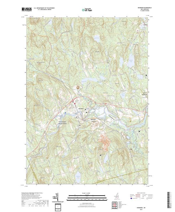
2024 Henniker
Merrimack County, NH
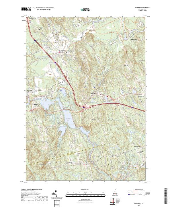
2024 Hopkinton
Merrimack County, NH

2024 Loudon
Merrimack County, NH

2024 Manchester North
Merrimack County, NH

2024 New London
Merrimack County, NH

2024 Northfield
Merrimack County, NH

2024 Penacook
Merrimack County, NH
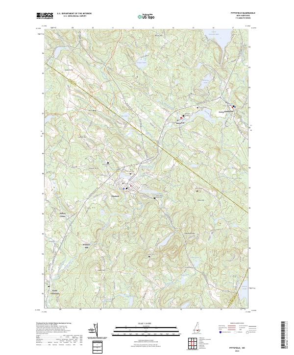
2024 Pittsfield
Merrimack County, NH
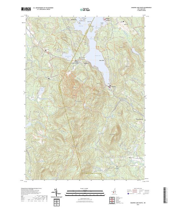
2024 Sunapee Lake South
Merrimack County, NH
2024 Warner
Merrimack County, NH

2024 Webster
Merrimack County, NH