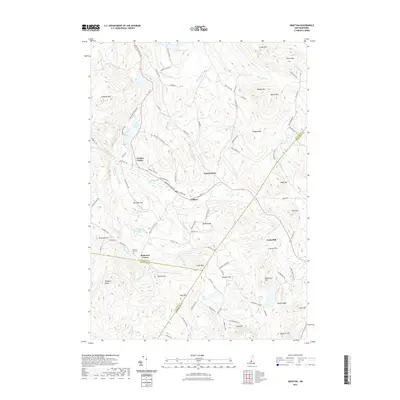
2021 Map of Grafton
USGS Topo · Published 2021About this map
Grafton serves as the central hub of this interior New Hampshire landscape, where the Smith River and its numerous tributaries like Mill Brook and Smith Brook wind through a complex topography of hills and ridges. The settlement pattern follows the narrow valleys and upland flats, connecting Grafton Center and East Grafton with smaller locales such as Robinson Corner and Fords Mill. The map reveals a deeply rooted rural community, evidenced by the Prescott Hill Cem and numerous family-named landmarks including Williams Hill, Prescott Hill, and Severance Hill.
Find a feature on this map
107 named features on this map. Tap any name to fly to it.
Don’t see what you’re looking for? This feature index may not catch every label — zoom into the map to look around manually.
Map Details
Editions of this 2021 Grafton Map
This is the sole edition of this map. No revisions or reprints were ever made.
Other maps of this area

1902 · Sunapee
USGS Topo · 1:62,500

1905 · Sunapee
USGS Topo · 1:62,500

1907 · Sunapee
USGS Topo · 1:62,500

1927 · Cardigan
USGS Topo · 1:62,500

1927 · Mascoma
USGS Topo · 1:62,500

1928 · Mount Kearsarge
USGS Topo · 1:62,500

1930 · Cardigan
USGS Topo · 1:62,500

1931 · Mount Kearsarge
USGS Topo · 1:62,500

1932 · Mascoma
USGS Topo · 1:62,500

1949 · Portland
USGS Topo · 1:250,000