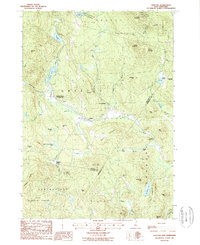
1987 Map of Grafton
USGS Topo · Published 1987About this map
Grafton and its surrounding countryside are defined by a high-elevation landscape of glacial ponds and granite peaks within the Mount Cardigan State Forest and Gile Memorial Forest. At the center of this map, the settlement of Grafton Center Cardigan Sta marks a historical rail point along the Smith River, serving as a gateway to the nearby Grafton and East Grafton villages. The terrain is marked by significant hydrological features such as Kilton Pond, Tewksbury Pond, and the expansive Three Thousand Acre Pond. Evidence of local industry and rural life appears through scattered cemeteries, gravel pits, and a mine near Isinglass Mtn. The map also captures the transition from agriculture and forestry to recreation, noted by the Golden Valley Ranch and the many named heights including Smith Mtn and Barber Mountain.
Find a feature on this map
62 named features on this map. Tap any name to fly to it.
Don’t see what you’re looking for? This feature index may not catch every label — zoom into the map to look around manually.
Map Details
Editions of this 1987 Grafton Map
This is the sole edition of this map. No revisions or reprints were ever made.
Other maps of this area

1902 · Sunapee
USGS Topo · 1:62,500

1905 · Sunapee
USGS Topo · 1:62,500

1907 · Sunapee
USGS Topo · 1:62,500

1927 · Cardigan
USGS Topo · 1:62,500

1927 · Mascoma
USGS Topo · 1:62,500

1928 · Mount Kearsarge
USGS Topo · 1:62,500

1930 · Cardigan
USGS Topo · 1:62,500

1931 · Mount Kearsarge
USGS Topo · 1:62,500

1932 · Mascoma
USGS Topo · 1:62,500

1949 · Portland
USGS Topo · 1:250,000