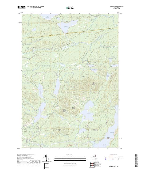
2023 Map of Grampus Lake
USGS Topo · Published 2023About this map
Adirondack Park dominates this terrain, where the northern border of Hamilton County meets Franklin County. The landscape is a network of glacial lakes and high ridges, anchored by Grampus Lake Mountain and Rock Pond Mountain. A series of interconnected waterways including Bog Stream, Moose Creek, and the chain of Upper Moose Pond, Lower Moose Pond, and Third Pond illustrate the complex drainage patterns of the high peaks region. Access to these remote waters is maintained through a system of local ways such as John Dillion Access Rd and Fish Camp Way. To the southeast, the famous Northville-Placid Trl skirts the edge of Long Lake at Landing Bay, marking a significant corridor for modern backcountry travel through this historically protected wilderness.
Find a feature on this map
48 named features on this map. Tap any name to fly to it.
Don’t see what you’re looking for? This feature index may not catch every label — zoom into the map to look around manually.
Map Details
Editions of this 2023 Grampus Lake Map
This is the sole edition of this map. No revisions or reprints were ever made.
Other maps of this area

1903 · Raquette Lake
USGS Topo · 1:62,500

1903 · Blue Mountain
USGS Topo · 1:62,500

1904 · Long Lake
USGS Topo · 1:62,500

1907 · Tupper Lake
USGS Topo · 1:62,500

1948 · Ogdensburg
USGS Topo · 1:250,000

1950 · Utica
USGS Topo · 1:250,000

1951 · Ogdensburg
USGS Topo · 1:250,000

1953 · Ogdensburg
USGS Topo · 1:250,000

1954 · Tupper Lake
USGS Topo · 1:62,500

1954 · Blue Mountain
USGS Topo · 1:62,500