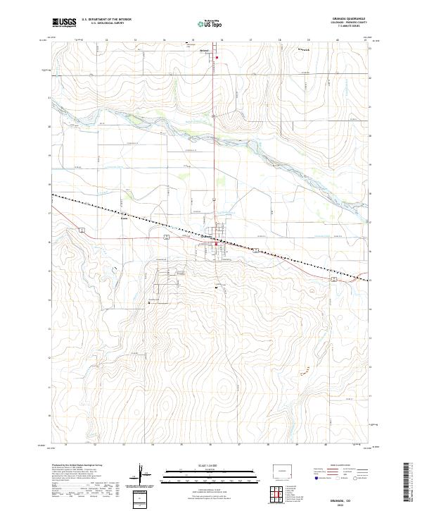
2022 Map of Granada
USGS Topo · Published 2022About this map
The town of Granada serves as the central hub of this eastern Colorado landscape, situated along the southern banks of the Arkansas River. This 2022 survey details a complex irrigation network vital to the region's agricultural character, featuring the Buffalo Canal, Lamar Canal, and Manvel Canal, along with the Granada Ditch and its branches. These waterworks define the settlement patterns between the river and the surrounding prairie, where smaller communities like Bristol, Warwick, and Koen are linked by a grid of county roads.
Find a feature on this map
64 named features on this map. Tap any name to fly to it.
Don’t see what you’re looking for? This feature index may not catch every label — zoom into the map to look around manually.
Map Details
Editions of this 2022 Granada Map
This is the sole edition of this map. No revisions or reprints were ever made.
Other maps of this area

1890 · Granada
USGS Topo · 1:125,000

1891 · Albany
USGS Topo · 1:125,000

1892 · Granada
USGS Topo · 1:125,000

1893 · Albany
USGS Topo · 1:125,000

1894 · Granada
USGS Topo · 1:125,000

1952 · Carlton
USGS Topo · 1:24,000

1953 · Holly West
USGS Topo · 1:24,000

1953 · Granada
USGS Topo · 1:24,000

1954 · Lamar
USGS Topo · 1:250,000

1955 · Granada NW
USGS Topo · 1:24,000