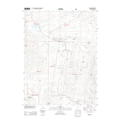
2013 Map of Granby
USGS Topo · Published 2013About this map
Granby serves as a central hub in this high-altitude landscape, situated where the Colorado River meets the Fraser River. The settlement pattern follows the valley floors, with the Granby-Grand County Airport and the Sulphur District Ranger Office anchoring the town's infrastructure. To the west, the Windy Gap Reservoir and its surrounding gap provide a gateway for water management via the Bunte Highline Ditch. The southern reaches of the map transition into the Arapaho National Forest, dominated by topographic landmarks like Ninemile Mountain and Mount Chauncey. Local history is preserved at the Eightmile School and Granby Cem, while the modern recreation economy is evident in the Silver Creek Ski Area and Tabernash Campground. This map documents a complex mountain geography where hydraulic engineering, ranching-era schools, and modern alpine tourism coexist.
Find a feature on this map
100 named features on this map. Tap any name to fly to it.
Don’t see what you’re looking for? This feature index may not catch every label — zoom into the map to look around manually.
Map Details
Editions of this 2013 Granby Map
This is the sole edition of this map. No revisions or reprints were ever made.
Other maps of this area

1915 · Longs Peak
USGS Topo · 1:125,000

1919 · Rocky Mountain National Park
USGS Topo · 1:125,000

1924 · Fraser
USGS Topo · 1:62,500

1926 · Fraser
USGS Topo · 1:62,500

1933 · Ute Peak
USGS Topo · 1:62,500

1937 · Ute Peak
USGS Topo · 1:62,500

1953 · Denver
USGS Topo · 1:250,000

1954 · Greeley
USGS Topo · 1:250,000

1954 · Craig
USGS Topo · 1:250,000

1957 · Denver
USGS Topo · 1:250,000