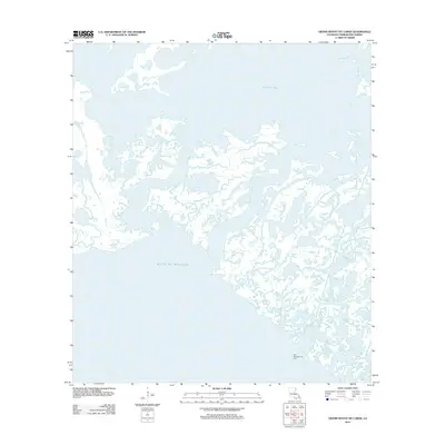
2012 Map of Grand Bayou du Large
USGS Topo · Published 2012About this map
Caillou Lake dominates the northern reaches of this coastal landscape in Terrebonne Parish, where the complex transition between freshwater bayous and the open Gulf of Mexico is meticulously documented. The map reveals an intricate network of tidal waterways, including Bayou Voisin and Fish Bayou, which define the fragile marshland geography of southern Louisiana. This environment is not only a natural interface of land and sea but also a site of industrial activity, evidenced by the Pass Des Ilettes Gas Field located in the southeastern quadrant. The lack of traditional roads or terrestrial settlements underscores the importance of waterborne navigation and the energy economy in this specific region of the Gulf coastline during the early 21st century, providing a clear record of the shoreline and maritime infrastructure near Turtle Bayou before further coastal changes.
Find a feature on this map
6 named features on this map. Tap any name to fly to it.
Don’t see what you’re looking for? This feature index may not catch every label — zoom into the map to look around manually.
Map Details
Editions of this 2012 Grand Bayou du Large Map
This is the sole edition of this map. No revisions or reprints were ever made.
Other maps of this area

1894 · Bayou De Large
USGS Topo · 1:62,500

1932 · Lake Decade
USGS Topo · 1:62,500

1935 · Lake Mechant
USGS Topo · 1:31,680

1935 · Oyster Bayou
USGS Topo · 1:62,500

1940 · Bayou Du Large
USGS Topo · 1:62,500

1941 · Bayou Du Large
USGS Topo · 1:62,500

1944 · Bayou Du Large
USGS Topo · 1:62,500

1945 · New Orleans
USGS Topo · 1:250,000
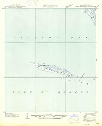
1947 · West Derniere
USGS Topo · 1:31,680

1949 · Grand Bayou Du Large
USGS Topo · 1:31,680