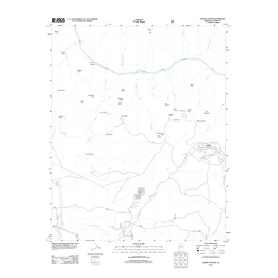
2012 Map of Grand Canyon
USGS Topo · Published 2012About this map
Grand Canyon village serves as the primary hub for human activity on the South Rim, showing a dense network of roads like Village Loop Dr and S Entrance Rd alongside park facilities. The infrastructure extends to the US National Park Service Grand Canyon South Rim Wastewater Treatment Facility, signaling the scale of modern tourism. Beyond the village, the landscape is defined by massive geological features such as Cope Butte, Dana Butte, and the dramatic drop of The Abyss. The Colorado River carves through the north, marked by significant water features including Granite Rapids and Horn Creek Rapids. Farther south, the transition to the plateau is marked by Coconino Siding and the various service roads of the National Forest, including FS Rd 328, which contrast with the intricate trails and lookouts like Hopi Point and Maricopa Point perched along the rim.
Find a feature on this map
81 named features on this map. Tap any name to fly to it.
Don’t see what you’re looking for? This feature index may not catch every label — zoom into the map to look around manually.
Map Details
Editions of this 2012 Grand Canyon Map
This is the sole edition of this map. No revisions or reprints were ever made.
Other maps of this area

1886 · Chino
USGS Topo · 1:250,000

1886 · Kaibab
USGS Topo · 1:250,000

1891 · Chino
USGS Topo · 1:250,000

1903 · Bright Angel
USGS Topo · 1:48,000

1906 · Bright Angel
USGS Topo · 1:48,000

1948 · Williams
USGS Topo · 1:250,000

1953 · Grand Canyon
USGS Topo · 1:250,000

1954 · Williams
USGS Topo · 1:250,000

1956 · Williams
USGS Topo · 1:250,000

1957 · Grand Canyon
USGS Topo · 1:250,000