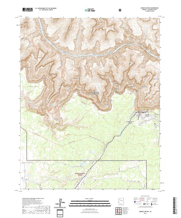
2021 Map of Grand Canyon
USGS Topo · Published 2021About this map
Grand Canyon Village serves as the focal point of human settlement on the South Rim, showing a dense network of local streets such as Coconino St, Havasupai St, and Albright Avenue. This survey illustrates the intricate relationship between the built environment of the village and the complex geology of the canyon below. The vertical landscape is defined by massive formations like The Battleship, Dana Butte, and Marsh Butte, which drop precipitously into the Granite Gorge. Along the Colorado River, the map identifies dangerous navigable points including Hermit Rapids and Boucher Rapids. Away from the tourist hubs, the landscape is marked by essential water infrastructure like Horsethief Tank and historical routes such as the Supai Village Old '328 Rd, which traverses the Kaibab National Forest.
Find a feature on this map
91 named features on this map. Tap any name to fly to it.
Don’t see what you’re looking for? This feature index may not catch every label — zoom into the map to look around manually.
Map Details
Editions of this 2021 Grand Canyon Map
This is the sole edition of this map. No revisions or reprints were ever made.
Other maps of this area

1886 · Chino
USGS Topo · 1:250,000

1886 · Kaibab
USGS Topo · 1:250,000

1891 · Chino
USGS Topo · 1:250,000

1903 · Bright Angel
USGS Topo · 1:48,000

1906 · Bright Angel
USGS Topo · 1:48,000

1948 · Williams
USGS Topo · 1:250,000

1953 · Grand Canyon
USGS Topo · 1:250,000

1954 · Williams
USGS Topo · 1:250,000

1956 · Williams
USGS Topo · 1:250,000

1957 · Grand Canyon
USGS Topo · 1:250,000