
1984 Map of Grand Canyon
USGS Topo · Published 1984About this map
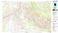
Supai stands as a central settlement within the Havasupai Indian Reservation on this 1984 survey, situated deep within the dramatic geography of the Grand Canyon. The map details a landscape defined by the winding Colorado River through the Granite Gorge, surrounded by massive formations like Shiva Temple and Wotan's Throne. Beyond the natural wonders, the survey documents the human infrastructure that makes the canyon accessible, from the Atchison Topeka and Santa Fe railroad line to the historic Bright Angel Trail and South Kaibab Trail. Notable landmarks such as the Desert View Watchtower and the Orphan Mine illustrate the intersection of early tourism and resource extraction. The map also delineates tribal and national boundaries, including the Hualapai Indian Reservation and Kaibab National Forest, providing a clear view of land management in Coconino County during the mid-1980s.
Find a feature on this map
104 named features on this map. Tap any name to fly to it.
Don’t see what you’re looking for? This feature index may not catch every label — zoom into the map to look around manually.
Map Details
Editions of this 1984 Grand Canyon Map
2 editions found
Other maps of this area

1886 · Diamond Creek
USGS Topo · 1:250,000

1886 · San Francisco Mtns
USGS Topo · 1:250,000

1886 · Mt. Trumbull
USGS Topo · 1:250,000

1886 · Chino
USGS Topo · 1:250,000

1886 · Echo Cliffs
USGS Topo · 1:250,000

1886 · Kaibab
USGS Topo · 1:250,000

1891 · San Francisco Mtns
USGS Topo · 1:250,000

1891 · Chino
USGS Topo · 1:250,000

1891 · Echo Cliffs
USGS Topo · 1:250,000

1892 · Diamond Creek
USGS Topo · 1:250,000