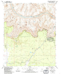
1988 Map of Grand Canyon
USGS Topo · Published 1988About this map
Granite Gorge dominates the northern half of this 1980s landscape, where the Colorado River carves through ancient rock, marked by turbulent waters such as Boucher Rapids and Hermit Rapids. The map illustrates the specialized infrastructure of Grand Canyon National Park at the time, showing the developed Grand Canyon village area complete with a Trailer Park and Sewage Disposal Ponds.
Find a feature on this map
76 named features on this map. Tap any name to fly to it.
Don’t see what you’re looking for? This feature index may not catch every label — zoom into the map to look around manually.
Map Details
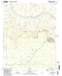
Editions of this 1988 Grand Canyon Map
2 editions found
Other maps of this area

1886 · Chino
USGS Topo · 1:250,000

1886 · Kaibab
USGS Topo · 1:250,000

1891 · Chino
USGS Topo · 1:250,000

1903 · Bright Angel
USGS Topo · 1:48,000

1906 · Bright Angel
USGS Topo · 1:48,000

1948 · Williams
USGS Topo · 1:250,000

1953 · Grand Canyon
USGS Topo · 1:250,000

1954 · Williams
USGS Topo · 1:250,000

1956 · Williams
USGS Topo · 1:250,000

1957 · Grand Canyon
USGS Topo · 1:250,000