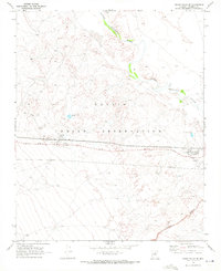
1969 Map of Grand Falls SE
USGS Topo · Published 1972About this map
The Navajo Indian Reservation landscape is defined by the winding course of the Little Colorado River and the stark descent into Canyon Diablo in the southeastern corner. This late 1960s survey documents the community of Leupp during a period of institutional development, marked by the presence of the Leupp Boarding Sch, the Leupp Sch, and a Headstart Sch. The infrastructure of the era is clearly visible, with a network of pipelines cutting across the desert floor, supported by a Compressor Station and Substation. This map provides a clear record of local transportation and utility expansion, from the Leupp Road corridor to the Sunrise Landing Field, showing how the arid terrain was navigated and utilized for education and energy transport.
Find a feature on this map
15 named features on this map. Tap any name to fly to it.
Don’t see what you’re looking for? This feature index may not catch every label — zoom into the map to look around manually.
Map Details
Editions of this 1969 Grand Falls SE Map
2 editions found
Other maps of this area

1883 · Tusayan
USGS Topo · 1:250,000

1886 · Tusayan
USGS Topo · 1:250,000

1886 · San Francisco Mtns
USGS Topo · 1:250,000

1891 · San Francisco Mtns
USGS Topo · 1:250,000

1894 · San Francisco Mtns
USGS Topo · 1:250,000

1899 · San Francisco Mtns
USGS Topo · 1:250,000

1947 · Flagstaff
USGS Topo · 1:250,000

1954 · Flagstaff
USGS Topo · 1:250,000

1955 · Winslow 2 SW
USGS Topo · 1:24,000

1955 · Grand Falls NE
USGS Topo · 1:24,000