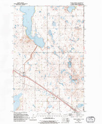
1994 Map of Grand Harbor
USGS Topo · Published 1995About this map
The settlement of Grand Harbor serves as a focal point in this portion of Ramsey County, situated along a transportation corridor that cuts through a landscape defined by glacial activity. The prairie pothole region is on full display here, with numerous wetlands and basins including Dry Lake and the oddly named Sew Disk Pond. Much of the eastern terrain is occupied by the Freshwater marshes and a dedicated National Waterfowl Production Area, highlighting the conservation efforts prevalent in the late 20th century. For those tracing local history, the Grand Harbor Cem and the small siding at Darby provide specific geographical anchors for the area's rural development. To the south, the waters of Sixmile Bay reach into the quadrangle, marking the transition toward the larger Devils Lake basin.
Find a feature on this map
19 named features on this map. Tap any name to fly to it.
Don’t see what you’re looking for? This feature index may not catch every label — zoom into the map to look around manually.
Map Details
Editions of this 1994 Grand Harbor Map
This is the sole edition of this map. No revisions or reprints were ever made.
Other maps of this area

1931 · Devils Lake
USGS Topo · 1:62,500

1932 · Grahams Island
USGS Topo · 1:62,500

1950 · Grahams Island
USGS Topo · 1:62,500

1950 · Devils Lake
USGS Topo · 1:62,500

1951 · Devils Lake
USGS Topo · 1:24,000

1951 · Grahams Island
USGS Topo · 1:24,000

1951 · Grand Harbor
USGS Topo · 1:24,000

1951 · Camp Grafton
USGS Topo · 1:24,000

1951 · Penn
USGS Topo · 1:24,000

1951 · Sweetwater
USGS Topo · 1:24,000