
1895 Map of Grand Island
USGS Topo · Published 1895About this map
Grand Island stands as a significant rail hub in Central Nebraska during the late nineteenth century, situated at the junction of several major transportation arteries. The platting of the city shows a dense grid established north of the Union Pacific R. R. (Main Line) and south of the Union Pacific R. R. (Ord Branch). This network is further expanded by the Burlington and Missouri River R. R. and the St. Joseph and Grand Island R. R., highlighting the area's critical role in regional commerce and westward expansion.
Find a feature on this map
35 named features on this map. Tap any name to fly to it.
Don’t see what you’re looking for? This feature index may not catch every label — zoom into the map to look around manually.
Map Details
Editions of this 1895 Grand Island Map
This is the sole edition of this map. No revisions or reprints were ever made.
Other maps of this area

1892 · Grand Island
USGS Topo · 1:62,500
1894 · Kenesaw
USGS Topo · 1:62,500
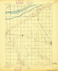
1895 · Wood River
USGS Topo · 1:62,500

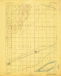
1896 · Wood River
USGS Topo · 1:125,000

1898 · Grand Island
USGS Topo · 1:125,000

1899 · Loup
USGS Topo · 1:125,000

1899 · St. Paul
USGS Topo · 1:125,000
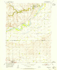
1953 · Dannebrog
USGS Topo · 1:24,000

1955 · Broken Bow
USGS Topo · 1:250,000

1955 · Grand Island
USGS Topo · 1:250,000