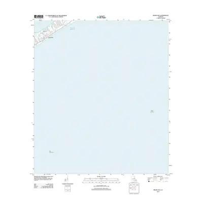
2012 Map of Grand Isle
USGS Topo · Published 2012About this map
Grand Isle stands as a narrow barrier between the sheltered bay waters and the open Gulf of Mexico, its limited land area densely organized along a network of residential lanes and avenues. This 2012 survey shows the community's layout just south of the mainland, where local life is centered around the Post Office and the Grand Isle Cemetery. The map captures the precarious nature of coastal settlement, where streets like Orleans Ave and Cypress Ln terminate abruptly at the shoreline.
Find a feature on this map
19 named features on this map. Tap any name to fly to it.
Don’t see what you’re looking for? This feature index may not catch every label — zoom into the map to look around manually.
Map Details
Editions of this 2012 Grand Isle Map
This is the sole edition of this map. No revisions or reprints were ever made.
Other maps of this area

1892 · Cheniere Caminada
USGS Topo · 1:62,500

1892 · Creole
USGS Topo · 1:62,500

1893 · Fort Livingston
USGS Topo · 1:62,500

1935 · Bay Ronquille
USGS Topo · 1:31,680

1945 · New Orleans
USGS Topo · 1:250,000

1947 · Caminada Pass
USGS Topo · 1:31,680

1947 · Bay Ronquille
USGS Topo · 1:31,680
1948 · Fort Livingston
USGS Topo · 1:62,500
1949 · Barataria Pass
USGS Topo · 1:31,680
1949 · Bay Tambour
USGS Topo · 1:31,680