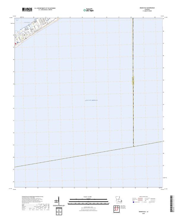
2025 Map of Grand Isle
USGS Topo · Published 2025About this map
Grand Isle stands as a thin barrier between the inland waters of Bayou Rigaud and the vast Gulf of America. This 2025 survey illustrates the dense residential and utility corridor concentrated at the northeastern end of the island, where a network of local roads like Orleans Ave and Humble Rd serve the community. The town's layout is defined by its narrow geography, squeezed between the bay and the beach, with family-named or plant-named lanes such as Walnut Ln and Nicarri Ln extending toward the shoreline.
Find a feature on this map
15 named features on this map. Tap any name to fly to it.
Don’t see what you’re looking for? This feature index may not catch every label — zoom into the map to look around manually.
Map Details
Editions of this 2025 Grand Isle Map
This is the sole edition of this map. No revisions or reprints were ever made.
Other maps of this area

1892 · Cheniere Caminada
USGS Topo · 1:62,500

1892 · Creole
USGS Topo · 1:62,500

1893 · Fort Livingston
USGS Topo · 1:62,500

1935 · Bay Ronquille
USGS Topo · 1:31,680

1945 · New Orleans
USGS Topo · 1:250,000

1947 · Caminada Pass
USGS Topo · 1:31,680

1947 · Bay Ronquille
USGS Topo · 1:31,680
1948 · Fort Livingston
USGS Topo · 1:62,500
1949 · Barataria Pass
USGS Topo · 1:31,680
1949 · Bay Tambour
USGS Topo · 1:31,680