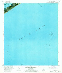
1973 Map of Grand Isle
USGS Topo · Published 1976About this map
Grand Isle serves as the thin coastal anchor for this orthophotomap, showing the developed barrier island before significant modern expansion. The town's grid and shoreline are visible alongside the protected waters of Bayou Rigaud and Bay Des Ilettes. This 1970s survey captures a landscape defined by the extraction economy of the Louisiana coast, dominated by the open waters of the Gulf of Mexico. Offshore, industrial infrastructure is the primary feature, specifically the Block 16 Oil and Gas Field and Block 18 Oil and Gas Field. These sites are marked by numerous platforms, illustrating the scale of energy production in the region at the time. The Barataria Bay Waterway cuts through the upper corner of the map, signifying the importance of maritime transit for the local community and industry.
Find a feature on this map
9 named features on this map. Tap any name to fly to it.
Don’t see what you’re looking for? This feature index may not catch every label — zoom into the map to look around manually.
Map Details
Editions of this 1973 Grand Isle Map
This is the sole edition of this map. No revisions or reprints were ever made.
Other maps of this area

1892 · Cheniere Caminada
USGS Topo · 1:62,500

1892 · Creole
USGS Topo · 1:62,500

1893 · Fort Livingston
USGS Topo · 1:62,500

1935 · Bay Ronquille
USGS Topo · 1:31,680

1945 · New Orleans
USGS Topo · 1:250,000

1947 · Caminada Pass
USGS Topo · 1:31,680

1947 · Bay Ronquille
USGS Topo · 1:31,680
1948 · Fort Livingston
USGS Topo · 1:62,500
1949 · Barataria Pass
USGS Topo · 1:31,680
1949 · Bay Tambour
USGS Topo · 1:31,680