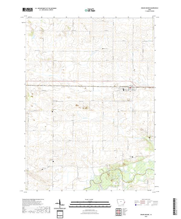
2022 Map of Grand Mound
USGS Topo · Published 2022About this map
Grand Mound serves as the central hub of this eastern Iowa landscape, where the town grid is defined by streets like DeWitt St and Clinton St. The surrounding countryside is heavily marked by its genealogical heritage, containing a high density of burial grounds including Dutton Cem, Kvindherred Cem, and Barber Cem. To the south, the terrain transitions into the wetlands and braided channels of the Wapsipinicon River, which forms the natural boundary between Clinton Co and Scott Co. The drainage of the land is further defined by several tributaries such as Calamus Cr and Crystal Cr. This 2022 survey captures the persistent rural structure of the region, where section lines are traced by a meticulous network of county highways and local roads like Kageman's Rd and Prairie Ln.
Find a feature on this map
42 named features on this map. Tap any name to fly to it.
Don’t see what you’re looking for? This feature index may not catch every label — zoom into the map to look around manually.
Map Details
Editions of this 2022 Grand Mound Map
This is the sole edition of this map. No revisions or reprints were ever made.
Other maps of this area

1890 · Durant
USGS Topo · 1:62,500

1891 · DeWitt
USGS Topo · 1:62,500

1891 · Davenport
USGS Topo · 1:62,500

1892 · Wheatland
USGS Topo · 1:62,500

1894 · Wheatland
USGS Topo · 1:62,500

1894 · Durant
USGS Topo · 1:62,500

1894 · Davenport
USGS Topo · 1:62,500

1901 · Rock Island
USGS Topo · 1:125,000

1910 · Rock Island
USGS Topo · 1:125,000
1953 · De Witt
USGS Topo · 1:24,000